TO WEB MAPPING
GIS
GIS (geographic information system) is a system that could creates, manages, analysis, and mapping all types of data on a virtual geographical map (or graph). All virtual or web maps are a platform or output of GIS.
Esri / ArcGIS
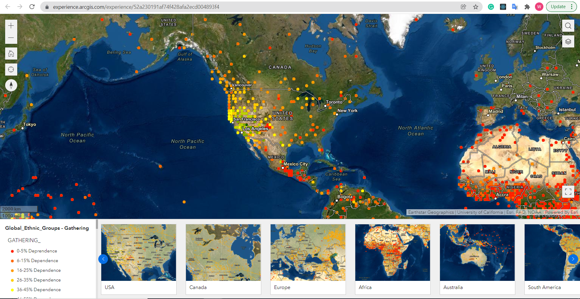 Esri is an international geographic information system supplier, and ArcGIS is online geographic information system service developed and maintained by Esri, letting people to creates and custom unique map.
In the manon web mapping couse, I learn web mapping using ArcGIS to creates unique maps through managing and analysing datas and layering data and information on the virtual map. Later in the couse, it slowly changing the perspective of web map from 2D to 3D and augmented reality (AR), virtual reality (VR), and mixed reality (MR) of mapping.
Esri is an international geographic information system supplier, and ArcGIS is online geographic information system service developed and maintained by Esri, letting people to creates and custom unique map.
In the manon web mapping couse, I learn web mapping using ArcGIS to creates unique maps through managing and analysing datas and layering data and information on the virtual map. Later in the couse, it slowly changing the perspective of web map from 2D to 3D and augmented reality (AR), virtual reality (VR), and mixed reality (MR) of mapping.
WiX
 In the process of the lesson, I use WiX created a websit to logging my works and maps.